Sunday, 15 February 2015

Woody Buttress (15/21)

A Table Mountain climb with the Hikers Paradise Club friends, led by Anwar Adams. This very enjoyable hike met all the expectations of the event notice:
"WOODY BUTTRESS - SUNDAY 15 FEBRUARY 2015
Grade B3 , +/- 4 hours, meet at Kloof Nek parking 06h00 for 06h15 start.
Woody Buttress is another amazing scramble route that thrills you all the way with its variance of scrambles offering awesome challenges and a few exposed moments which is easily ventured as experienced hands are always at hand for encouragement and assistance. generally not for the faint hearted as we will not be using rope as some would advise. Hence you hike at your own risk.".


Yes it was an early start from Kloofnek. under cloudy skies. with a bit of drizzle along the Pipe Track
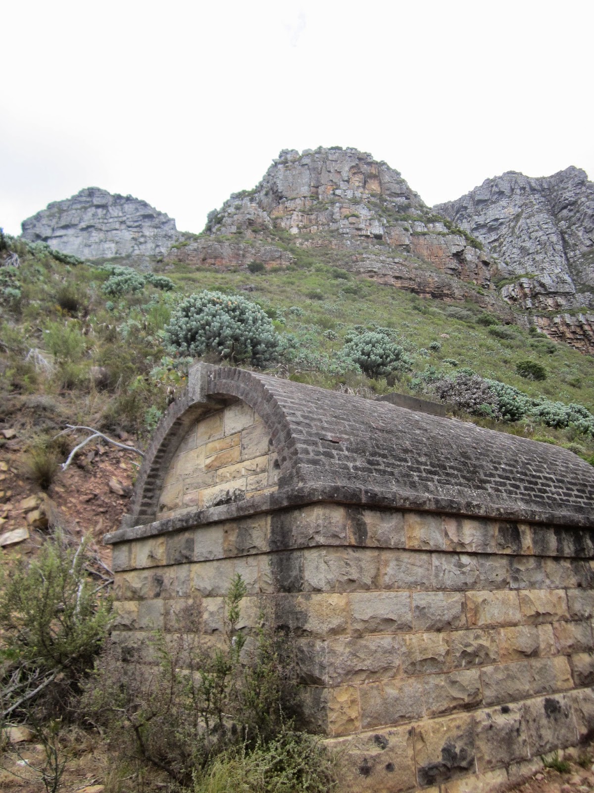
After walking for about 4km and passing the Diagonal Route and Kasteelspoort signboards, you come across this elderly relic, and the path up to Woody Buttress (above) ascends just further on, where the path is lined on the downside with spider gum Eucalyptus trees.


Looking back on the Pipetrack trail we had taken, with some of the Apostles in attendance.


And to the other side the Pipetrack contour path goes a bit further to Slangolie ravine, and ends with the ascent of Corridor ravine.


The route was refreshingly varied with scrambling bits that were quite demanding, and other ridge line sections like this,


And magnificent views like this one into Woody Ravine


Energy sapping ascents.


And that smile when you emerge at the top! 


Well still a bit more to go, but that is the final "top". Does that rock look a bit like an elephant?


I saw about four flowering Cluster Disas (d. ferruginea)


We reached the Apostles path with a strong wind blowing and I had to do a hat recovery move. It was not a good place to stop for Breakfast so we started down Woody Ravine.


And made breakfast camp a little way down where there was some wind protection and soft places to sit.


 Then down Woody Ravine to the Pipetrack and back to Kloofnek.  Lots of walkers on the Pipetrack, but a pleasant cool walk back. Most of the hike was under overcast skies, with a bit of sunshine on the last stretch. 


The Android GPS says it was 11 km distance with +500m of climb and we did it in 4h 7 m.

Sunday, 8 February 2015

Orange Kloof (14/20)

Orange Kloof - always restricted access - somehow never been there before, so grabbed an opportunity to go with Meridian Hiking Club meet led by Karen Watkins.  This was a hike to Woodhead Tunnel/Hell's Gate along ring road and back the same way.  About 9 km distance and 4 hours in total.


Left Constantia Nek at noon, in a party of 8, at last able to go this way!


A stop at Parrot Ravine where the overflow of De Villiers Reservoir provides a good stream.


Ascending steadily to the top of the Hout Bay valley, with the Sentinel the most remote point looking back down.


A magnificent Harveya capensis - a parasitic plant.


I think a rain spider lives here.


At the top of the ring road we took the trail towards Disa Kloof. Looking back to the Constantia corner ridges.


And Vlakkenberg and the Constantiaberg/


Tritoniopsis


Bridget picked out a special one that could easily have been mistaken for another red Tritoniopsis. The cluster disa (Disa ferruginea).


Also saw quite a few of the blue Disa graminifolia.


We descended to the Disa stream.  Most of the group avoided the dodgy footbridge with the rotten timber centre.


Or you did the duck walk.


Round a corner and there in front was this surprise.  Hell's Gate - a deep gorge leading straight to a dead end wall, with the Disa stream entering from a side ravine.


This is the Disa stream dropping steeply down into the gorge.


And the portal of the Woodhead Tunnel dated 1891, which used to take water from this side of the mountain (and the Table Mountain dams) through the Twelve Apostles to Camps Bay pipe track and down to the city!


An exquisite clump of Disa uniflora right there above the tunnel.


A bit disappinted with the colour of the photos from our very simple Canon compact,


so I borrowed one of Karen's pictures here.  


The lunch spot on a ledge above the Hell's Gate gorge.


The end wall of the gorge, with lush vegetation and more disas.


I climbed halfway down and took a picture looking downstream.


The lunch spot ledge again.


And the Disa stream coming down to the gorge.


Our group, plus Bob the photographer.


With a woolly sheep in the background.


Sunday, 1 February 2015

Myburgh's Waterfall Ravine disa walk (13/19)

Our party of four (Bridget, Jacques, Kathie and I) set off from Ruyteplaats parking at Suikerbossie above Hout Bay and ascended onto the contour path which we followed eastward for about an hour, then up Myburgh's Waterfall Ravine.


We reached the lower waterfall which had a small trickle, and saw about four disas here high up on the left side. To continue we went back a short way and scrambled up a path on the left before descending later back to the streambed.


After another 15 minutes along the river bed we got up close to quite a lot of the flowers in a beautiful dripwall terrace on the right side of the kloof.


Bridget talking to a disa.


Further on the kloof narrows into an impressive steep canyon with sheer walls on each side, for about 500 metres before reaching the top waterfall where a path to the side takes you up a steep earthy scramble path and out into the open upper stream with disas a-plenty.


After climbing the steep green slope, we made a tea stop under a shady rooiels tree.


Agapanthus looking good too.


Then we carried on up on the left bank of the upper stream to the summit plateau where we sometimes lost the path as it went through boggy wetland. We joined the main Apostles path and soon were able to look out over the Atlantic ocean.


Lion's Head and the Western Table.


And in the other direction Sandy Bay, Karbonkelberg and Oudeschip point.


Heading further north we had a glimpse of Llandudno beach and then reached the head of the steep Llandudno Ravine.


Where we went down..


Down, down


And around to the left, then more down..


For a lunch break at the bottom of Llandudno Ravine.


Contouring around below the impressive cliffs of Eureka Face.


And from there went again steeply down - Hout Bay Corner - aided by more of the useful "staples" - the stainless steel handles anchored into the rock face,


Almost back to the start.  Hout Bay, with the pine plantation above Ruyteplaats in the forground.

It was a very enjoyable, fairly demanding hike with lovely scenery and the disa display met all expectations!  5 hours 50 minutes; about 8.5 km with 600m elevation gain.