Sunday, 28 December 2014

Skoorsteenberg attempt (11/14)

I could not find my Slingsby map of Houtbay area this morning, and just hoped that I could wing it to the intended destination of Skoorsteenberg. Not a good idea!  

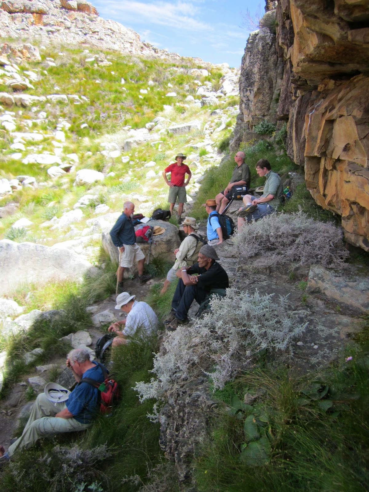
We set off from Tokai Arboretum and I started making route mistakes already while on the plantation paths and roads.  Eventually got onto the tarred mast road and found the correct path leading off to the right just after the Hoerikwagga trail meets the tar road.  Followed it for about half a k, but wasn't quite sure exactly where the path was heading or which of the high points was Skoorsteenberg!  So we stopped on some rocks at a nek where the path started to descend and called tea break.


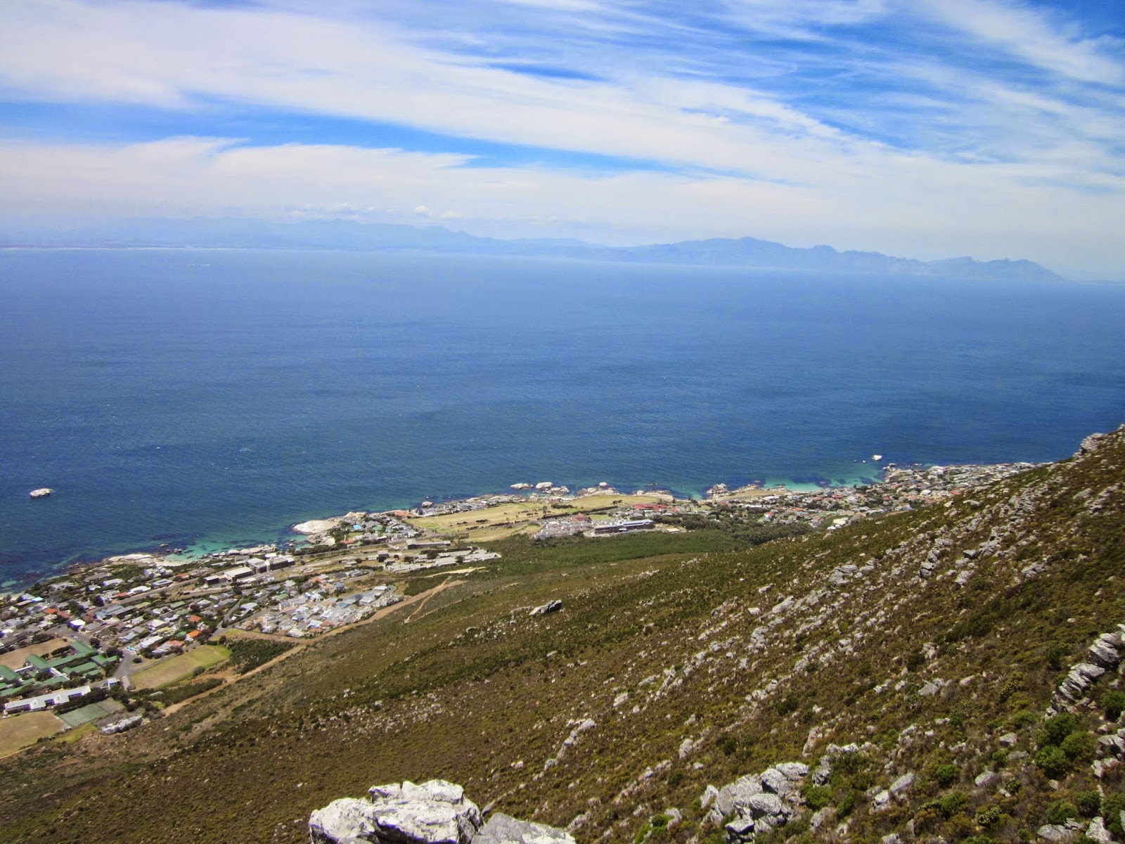
While the family rested here with views towards Hout Bay and the Sentinel, I climbed up the closest peaklet immediately behind/to the right in this photo. As usually happens I reached the top to discover that there was a higher peaklet further, but I wasn't going there!


Later when I was able to study the map, I realized that none of these points were Skoorsteenberg, and that it was the one directly above Christopher's head in the picture above, and that the path would have taken us there. But it was a hot day, and after enjoying the views we were happy to go no further and headed back home.


The trail that goes along the western side of Constantiaberg and eventually descends to the Old Manganese Mine.


We took the mast road again for a while, but turned off to descend the Boekenhoutkloof path, and then along the jeep tracks and pine forests of Tokai back to our car.


Saturday, 29 November 2014

Simonsberg and upper Simon's Town waterfall (10/10)


MCSA hike. We met at Red Hill farm at 8.30am, left some cars there, and drove to the start above Seaforth. Although distance covered was only 5.7km with 450m of climb, we were out for 7 hours, as it was largely off-path with some scrambling, and at a very easy pace.


Route description by meet leader Martyn Trainor: "Start up the mule track and then via the Baboon’s Armchair rocks to the North Peak summit of Simonsberg. Down the western slope to near the old Signal School and then on to Redhill Farm via the secret Simon’s Town Falls and associated famous pools."


The Swartkop Spiderhead (Serruria hirsuta), along the mule track path.  It only occurs on north facing slopes on this block of mountains, a few kms in extent.  Worth planning another hike along here in prime flowering time around June/July, going by the beautiful photos posted on iSpot.


At the Baboon's Armchair rocks we stopped to have a bit of fun going through the crack in the backrest slab.  Martyn here providing tips on how best to do it.


Pieter


Out the other side ..


That's the backrest slab. The seat rocks are in front of it. It is possible to identify where these rocks broke away from the main cliff high up on the mountain and came tumbling down to rest here.


Simon's Town naval dockyard. Martyn ex-Navy man has lots of interesting facts and stories to tell.  South-easter cloud forming over Kalk Bay mountains.


After some easy scrambles and a clever little move under and through the jumble of slabs and boulders we emerged on the summit of North Peak for our lunch stop. 

360 degree anticklockwise sequence starting here.


North-west: the Navy dams and a glimpse of Scarborough beach in the distance.


West: Klawer Valley military munitions depot and shooting range.


South-west: Upper Klawer Valley


South: along the ridge towards the main peak of Simonsberg.


South-east: Boulders beach  etc


North-east: Seaforth and False Bay


And back to where we started.


On the move again, picking our way down the western slopes of Simonsberg.


Red Mimetes cucullatus


At the old Signal School, the grave of Just Nuisance. I wonder if there are any other dog graves like this?


The secret pools above the upper waterfall where we immersed ourselves. Ladies pool.


Mens' pool - only just deep enough to lie down in (Martyn has alternative names for these pools!)


The Admiral's waterfall gap with one of the navy ships visible.


And more of Simon's Town. The little pimple on the mountain at right top is where we had our lunch!


Sunday, 23 November 2014

Newlands Forest Contour Path (9/9)

No pictures for this one!  Bridget and I set off from Newlands forest station parking at about 1.30pm, past the fire fighting helicopters and up the Littlewort trail. The first feathered attraction was an elusive group of red rumbed Swee Waxbills flittering through the fynbos. Further up we came across a few pairs of my favourite little forest bird, the Cape Batis, warning each other of our presence with their rattling alarm calls. We crossed the stream and continued on the left bank, following the route that I have often done with the Thursday VOB trail group, and eventually reached the contour path, after much more uphill, and took a break at the Ascension Gully stream.

I love this magnificent contour path and its boardwalks through forested ancient screes of mossy boulders and ferny undergrowth under the indigenous tree canopy. The thickest and tallest forest giants we have yet to identify, but we were alarmed at how many of another smaller trees species had been subjected to bark stripping (presumably for the muti/herbalist trade). Most had been sealed later by with a black potion but some had clearly been attacked again after the black gum had been applied.

After Newlands Ravine and the tree house picnic spot, we passed Dark Gorge and First Waterfall Ravine, the cleared area with ericas and watsonias flowering, and entered the blue gum forests flanked on the left by the steep cliffs of the Graafwater mudstones and shales. Beyond that section, we made our tea spot on a soft fynbos bank not very far from the u-turn before the Blockhouse.

After tea and biscuits we took the rather overgrown diagonal path back down the bracken dominated slopes to the upper jeep track, which we followed down into Newland Forest and back to our start.

Distance about 7.3 km.  Time 2 h 55 m. Climb 400 m.


Thursday, 6 November 2014

Clovelly Ridge circuit (8/7)

Our walk started from Sunbird Centre off Ou Kaapse Weg.


 We crossed the stream wetland over a plank bridge and followed the trail up the Silvermine river valley, past some old ruins that Slingsby calls the Powder House.


The most striking vegetation features were the large pincushion trees (Leucospermum conocarpadendrum) dense with yellow flowers and talk pink Watsonias.


On one of the buchu (agathosma) bushes were these beautiful brown beetles with shiny papery brown and black wing cases. Later idenfied ast Lycis (net-winged beetle).


It is always a treat to come across the exquisitely painted Galdiolus carneus.


Love the vanilla smell that Struthiola gives off in the evenings, but this was midday, so looked more closely at its delicate tiny flowers.


We various straw flowers (everlastings)


Pelargonium triste/ kaneelblom (cinnamon scented).  Below, one with its grapefruit sized tuber exposed on the sandy path.


Another little pelargonium (P. longifolum we think)


Roella ciliata


And some beautiful mountain dahlias (Liparia spendens)


Our lunch stop was just opposite the Amphitheatre, where the Cave Peak path branches off.


Penaea mucronata making a colourful picture in front of us.


After lunch we took a wrong path and got lost on Cave Peak, first going one way then another way, and finally relocating back to where we had lunch, and realizing that we had taken a minor path from our lunch stop, instead of the main Cave Peak path.

Once we were on the main path, we crossed the ridge and descended past Devil's Pit and then to Boomslang cave.  Heard flapping/whistling sound above us in the mist and found that some people had strung up a cable or slack line apparatus spanning about 50 metres above the lntrances to the caves. With the strong wind blowing and south easter mist it was obviously not a good day to perform a Go Pro stunt , though. I wonder if they ever did what they intended to?

Then we descended down to Trappieskop saddle, finding the scramble down the rock ledges quite tricky (is there a better way that I am unaware of?).  After that it was down the stony path to the Clovelly streets, along the golf course, and then back up the Silvermine valley to our car. That last bit not very enjoyable, a soft sandy track into the afternoon sun, with uninteresting vegetation with aliens,


But there was at the end a rewarding crossing of the Silvermine stream, with lovely yellow Wachendorfia thyrsiflora (Butterfly lilies) and Psoralea along the banks.

Distance 11.3km, elevation gain 500m, duration 4h 38 minutes.

Saturday, 1 November 2014

Maltese Cross (7/6)

Saturday's hike was to the Maltese Cross from the parking at the end of the track from Dwarsrivier farm.


As was the case yesterday, there were so many beautiful and interesting plants, and I took many pictures to identify or remember. This was one of a few Chasmanthe flowering.


Nearly at the top of the valley, we stopped for a break in the shade of the cliffs.


That is such an impressive rock formation against that wonderful sky.


Just next to the Maltese Cross there is this impressive example of sedimentary rock folding, standing all on its own.


The blue lizards kept me entertained for a few minutes on the way down.

At the beginning of the day's hike, after crossing the stream and ascending the trail for about 1 km up the Bokveldkloof, the breeze from the north-east had carried the sound of tumbling water up to us.  It seemed to be coming from further up the stream that we had crossed and where I noticed some rock bands intersecting the river course.  It seemed worth exploring so near the end of the hike I ran ahead of the group and went exploring....


The pool that I discovered far exceeded what I thought might be there!  I took some pictures and had a swim, then went off to tell the others and get them there.


It was only about 500m directly from the car back across the undulating grassy flats.


The guys were suitably impressed and some considered it the highlight of the day!


Later, back at Driehoek, David and I went for another walk of about an hour on one of the farm routes to a view point and some bushman paintings.


We reached the overhang and found an arrow sign pointing upwards but still took some time to find these two figures of a buck and a human.


The site has had a lot of weathering and possibly also fire damage, and much of the rock has flaked off.  There were small smudges of other figures that suggested there was a bigger scene visible long ago.  Not very impressive, but the excursion did satisfy some more of that need to explore and see what is at the end of the map/trail.

That evening I took Colin, William, David and Tony to the Cederberg Observatory for the slide presentation and telescope viewing. The talk/slides were good and up to date, but a bit disappointing through the telescopes, as the sky was bright with a large moon and no Jupiter or Saturn up.


The next morning we went up the Waterfall path for about 30 minutes, had a communion service among the rocks next to the second waterfall and pool, and then a group photo and lekker skinny dip!  Packed up and left for home by midday.